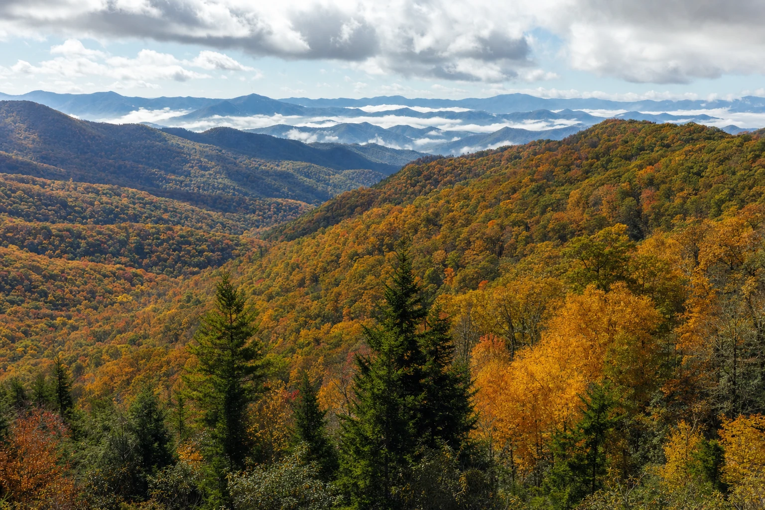

Newfound Gap Road — officially US-441 — is the central artery of Great Smoky Mountains National Park. In 33 miles it climbs from roughly 1,200 feet at the Gatlinburg entrance to 5,046 feet at Newfound Gap, then descends the same amount to the Oconaluftee Visitor Center at the North Carolina edge of the park near Cherokee. Along the way it crosses every ecological zone in the park: low-elevation mixed deciduous forest, mid-elevation hardwoods, the high spruce-fir zone rare east of the Rockies, and back down. It is the only road that crosses the park ridge-to-ridge, making it the single most efficient way to sample the Smokies in a day.
Practical basics
- Length: approximately 33 miles, one-way end to end.
- Drive time: 1.5 to 2 hours without stops. Budget three to five with stops.
- Elevation range: ~1,200 feet to 5,046 feet.
- Seasonality: open year-round, with temporary closures for snow and ice. The Kuwohi spur (the road to Kuwohi, formerly Clingmans Dome) closes every year from December 1 through March 31.
- Park entrance fee: none. The park does not charge admission.
- Parking tags: required for any parking over 15 minutes anywhere inside the park — $5 daily, $15 weekly, $40 annual. Buy in advance through recreation.gov.
The road is well-maintained and generally accommodates RVs, though certain pullouts are tight. Chimney Tops Overlook, in particular, has a small lot that RVs should approach carefully or skip entirely.
From Gatlinburg to Newfound Gap
The road enters the park just south of downtown Gatlinburg. The first miles wind along the West Prong of the Little Pigeon River, a stretch prone to congestion in peak season as cars decelerate from town speed into park pace. Drive the road early — before 9 AM — and the experience changes completely.
- Mile 2.5 — Sugarlands Visitor Center (elevation ~1,500 ft). The essential first stop. Restrooms, gift shop, ranger information, natural history exhibit. Several trails depart from here, including the flat, paved 1.9-mile one-way Gatlinburg Trail (pet-friendly and bike-friendly, unusual for the park) and the short Cataract Falls loop. Large parking lot, RV-friendly, but it fills quickly during peak. River views behind the center make for good soft-morning-light photography.
- Mile 7 — Campbell Overlook (elevation ~3,000 ft). An east-facing pullout with broad ridge and valley views. Best at sunrise, when the early light picks out the stacked layers of ridges the Smokies are famous for. Moderate pullout, a couple of RVs fit comfortably.
- Mile 10 — Chimney Tops Overlook (elevation ~3,800 ft). A dramatic west-facing view of the twin Chimney Tops peaks — rocky pinnacles rising from the ridge. The finest sunset light in this section of the park lands here. The associated Chimney Tops Trail is a strenuous 3.3-mile round trip; the trailhead parking lot is small, fills early, and can overflow dangerously onto the road. Off-peak visits or early arrivals are essential for the hike.
Between Chimney Tops and Newfound Gap, the forest transforms. The hardwoods give way to red spruce and Fraser fir — a southern Appalachian spruce-fir "sky island" ecosystem that mirrors boreal forests far to the north. The air cools noticeably. Roll down the windows for the smell of the firs.
Newfound Gap itself
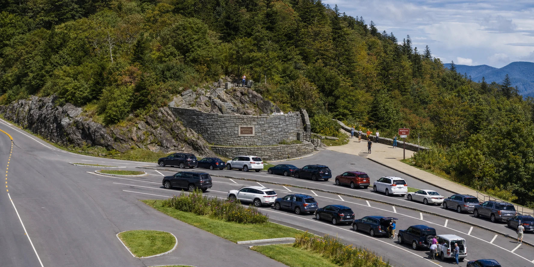
Mile 15.5 — Newfound Gap (elevation 5,046 ft). The pass, the state line, and one of the park's most photographed spots. The Rockefeller Memorial — a stone terrace dedicated by President Franklin D. Roosevelt in 1940 — commemorates the John D. Rockefeller Jr. family's $5 million contribution that helped finalize the park's land purchases. The Appalachian Trail crosses US-441 here; it is a popular starting point for short day hikes along the AT in either direction, with some of the best ridgetop views available without serious effort.
The main Newfound Gap parking lot is the largest high-elevation lot in the park and generally accommodates RVs and larger vehicles. It also fills completely by mid-morning on peak-season weekends. Views are panoramic in every direction. Weather changes fast at this elevation — carry layers even in summer, when a warm day in Gatlinburg can be 15-20 degrees cooler and windy at the gap.
The Kuwohi spur
At Newfound Gap, the Kuwohi Road spurs off US-441 and climbs seven more miles to a parking area just below the summit of Kuwohi (6,643 feet), the highest point in the park and the third-highest peak east of the Mississippi. From the lot, a paved but steep half-mile walkway leads to the distinctive concrete observation tower at the summit, delivering 360-degree views — on a clear day, reaching into seven states.
A few points:
- Name change: the mountain was officially renamed from Clingmans Dome to Kuwohi in 2023, restoring the Cherokee name used since long before European settlement. The rename was requested by the Eastern Band of Cherokee Indians and approved by the US Board on Geographic Names. Signs, maps, and park materials have been updated.
- Seasonal closure: Kuwohi Road closes December 1 through March 31 for winter. It also closes episodically for severe weather outside that window.
- Parking: large lot at the top, but it fills completely during peak and on any clear weekend. Arrive early or late for parking.
- RV access: the road accepts RVs, but parking at the summit for larger vehicles is tight during peak.
From Newfound Gap to Cherokee
Descending south into North Carolina, the character of the drive shifts. The long views open up over the gentler, more-undulating NC side of the park.
- Mile 17 — Mortons Overlook (elevation ~4,700 ft). A west-facing pullout famous for sunset, and the specific spot photographers head to for the "smoky" effect — layers of mist and fog filling the valleys below, lit gold from behind. Moderate-sized pullout.
- Mile 25 — Oconaluftee Valley Overlook (elevation ~3,200 ft). East-facing, commanding views of the Oconaluftee River valley and the distant peaks. Excellent morning light. Spacious, very RV-friendly.
- Mile 26 — Webb Overlook (elevation ~3,000 ft). Another east-facing pullout, similar orientation and feel to Oconaluftee Valley but at slightly lower elevation with a different take on the river valley.
- Mile 29 — Smokemont Campground. A large, developed NPS campground — individual tent and RV sites, restrooms, access to the Bradley Fork Trail. A popular base for exploring the NC side of the park.
- Mile 31 — Oconaluftee Visitor Center (elevation ~2,000 ft). The NC-side counterpart to Sugarlands. Information, gift shop, exhibits, restrooms. The adjacent Mountain Farm Museum is a collection of historic log buildings — cabin, barn, smokehouse, apple house, blacksmith shop — relocated from various pre-park Smokies settlements and reassembled into a single working farmstead display. The fields around the visitor center are the park's most reliable elk viewing location, especially at dawn and dusk.
Beyond Oconaluftee, US-441 exits the park boundary and enters the lands of the Eastern Band of Cherokee Indians, leading directly into the town of Cherokee, North Carolina — the cultural heart of the Qualla Boundary, home to the Museum of the Cherokee People, the Oconaluftee Indian Village, and the outdoor drama Unto These Hills.
Traffic patterns and how to drive the road well
- Weekdays beat weekends, always, by a wide margin. Saturday traffic in peak fall can crawl end-to-end for hours.
- Early morning (before 9 AM) and late afternoon (after 4 PM) are the clearest windows. Midday during peak season means constant stop-start behind slow-moving cars at every overlook.
- Fall foliage peak (mid to late October) is the busiest time of year. If committing to a peak-foliage drive, treat it as an all-day commitment and plan to be stationary often.
- Summer weekends and spring wildflower weekends produce secondary peaks, though less intense than fall.
- Shoulder seasons — late April through early May, and late September — offer the best balance: comfortable temperatures, open Kuwohi spur, manageable crowds, and real scenery.
Photography by time of day
- Sunrise: Campbell Overlook, Oconaluftee Valley Overlook, Webb Overlook — all east-facing, optimized for early light.
- Mid-day: Newfound Gap (panoramic, less sun-angle dependent), Sugarlands river scenes (soft light under canopy).
- Sunset: Chimney Tops Overlook and Mortons Overlook — both west-facing, classic golden-hour subjects.
- Morning fog and inversions: Newfound Gap and the Kuwohi overlooks after a cool clear night. The dramatic "smoky" layered-ridges photograph is most achievable in those conditions.
Newfound Gap Road is the corridor that introduces most visitors to the scale of the Smokies — to the fact that a single road can carry you through multiple forests, across a state line, past a memorial dedicated by Franklin Roosevelt, and into the Cherokee homeland, all in an afternoon. Drive it once fast to get a sense of the whole. Drive it again slow, with the stops, to feel the park.
The two visitor centers
The road is anchored by visitor centers at both ends, and each deserves a real stop.
- Sugarlands Visitor Center (TN side, mile 2.5): The natural history exhibit walks through the park's ecology and geology. Ranger-led programs run daily during peak season. The adjacent trail network — Gatlinburg Trail, Cataract Falls — makes this a legitimate destination on its own, not just a waypoint. The large parking lot usually absorbs RVs and tour buses without issue.
- Oconaluftee Visitor Center (NC side, mile 31): The Mountain Farm Museum behind the center is an open-air collection of relocated pre-park log structures — a cabin, barn, smokehouse, apple house, and blacksmith shop — arranged into a single working farmstead. The surrounding fields are the single most reliable place in the park to see elk, reintroduced to the park in 2001 and now a self-sustaining herd. Dawn and dusk are the best times; bulls bugle through the autumn rut.
Between the two, the road delivers every major ecosystem and the best-known viewpoints in the park. Between Cherokee (at the south end) and Gatlinburg (at the north), the road also connects to the Blue Ridge Parkway, which begins immediately south of Cherokee at Milepost 469 — the final mile of the 469-mile Parkway, looping back to North Carolina's high country and eventually to Shenandoah. Pairing the two drives turns Newfound Gap into the opening leg of one of the classic Appalachian road trips.