

Smokies guide
Smokies Scenic Overlooks
Every named pullout and overlook on Newfound Gap Road, Foothills Parkway, the Blue Ridge Parkway's southern section, Cherohala Skyway, and the Cades Cove Loop.
63 entries across 12 locations checked against official sources.
The best overlooks in the Smokies are Newfound Gap (5,046 feet, on the state line), Mortons Overlook and the Oconaluftee Valley Overlook on Newfound Gap Road, Chimney Tops Overlook for sunset, and the Foothills Parkway pullouts on the Tennessee side. Sunrise favors east-facing stops and sunset favors west-facing ones. Carlos Campbell Overlook on Newfound Gap Road is temporarily closed as of October 2026.
The park built most of its overlooks in the 1930s: stone walls, graded pullouts and short trails to a view. They are still the fastest way to see the Smokies without leaving your car. This index covers the named overlooks on Newfound Gap Road (US-441), the Foothills Parkway, the Cades Cove loop, the Blue Ridge Parkway between Cherokee and the Balsam Mountain turnoff, the Cherohala Skyway and Heintooga Ridge Road. Each page lists the road, the milepost or location, elevation, best light, the view and typical parking. For the full drives, see the guides to Newfound Gap Road and the scenic drives hub.
Cloud inversions, when valley fog fills a hollow while the ridgetops stay clear, are common on late-fall mornings at higher overlooks such as Newfound Gap, Kuwohi (formerly Clingmans Dome) and the high points of the Foothills Parkway. A clear, cold morning after rain the day before is the classic recipe.
Plan smarter
Sunrise vs sunset
East-facing overlooks (Oconaluftee Valley, Webb) light best at sunrise. West-facing ones (Mortons, Chimney Tops, Foothills Parkway, Look Rock) glow at sunset. Plan the day around the light.
Check roads before you drive
Newfound Gap Road, Kuwohi Road, the Blue Ridge Parkway and high Foothills Parkway sections close for ice, snow and wind. Kuwohi Road is open April 1 to November 29 in 2026. Check nps.gov/grsm and nps.gov/blri the morning you go.
Parking fills early
Kuwohi, Newfound Gap and Mortons fill by about 10 a.m. on peak weekends. Go at dawn or late in the day, and remember that stops over 15 minutes in the park need a $5 parking tag.
Townsend 14 entries
Townsend, TN
Cable Mill Historic Area
Cable Mill Historic Area is the loop's midway stop in Cades Cove, with a water-powered gristmill, a barn, a blacksmith shop and the visitor center; open daily through November 29.
Townsend, TN
Cades Cove Methodist Church Pullout
The Cades Cove Methodist Church, a small white frame church built in 1902, stands beside the loop road with a quiet cemetery, one of three historic churches you can walk up to.
Townsend, TN
Cades Cove Missionary Baptist Church Pullout
The Missionary Baptist Church in Cades Cove, a white frame building from 1915 with a cemetery beside it, is a short stop on the loop's far side near the Rich Mountain Road turnoff.
Townsend, TN
Cades Cove Overlook (Before Loop Entrance)
A pull-off on Laurel Creek Road a mile or two before the Cades Cove Loop gate: a quiet place to look at the creek and ridges, check your plan, and let the line ahead sort itself out.
Townsend, TN
Cades Cove Primitive Baptist Church Pullout
The Cades Cove Primitive Baptist Church, organized in 1827, stands in a clearing on the loop with a graveyard of the cove's first families, and its 1887 building is a plain frame church.
Townsend, TN
Cades Cove Wildlife Pullouts
Cades Cove's open meadows are the park's best place to see white-tailed deer, wild turkeys and black bears, and the wide shoulders of the loop road are the viewing spots; go at dawn or dusk.
Townsend, TN
Carter Shields Cabin Pullout
Carter Shields Cabin is the last historic stop on the Cades Cove Loop, a small log cabin by the road with deer in the field behind it and a short walk from the car.
Townsend, TN
John Oliver Cabin Pullout
The John Oliver Cabin is the first historic stop on the Cades Cove Loop, a short walk from the road to a log house built by the cove's first permanent settler family.
Townsend, TN
Meigs Creek and Meigs Falls Pullout
A pull-off on Little River Road near The Sinks marks the Meigs Creek trailhead and a roadside view of the river; Meigs Falls can be seen across the water from a pull-off a mile west.
Townsend, TN
Parson Branch Road Pullouts
Parson Branch Road is a narrow one-way gravel road of about eight miles from the Cades Cove area to US-129, with creek crossings and forest pull-offs; it is open through November 9, 2026.
Townsend, TN
Rich Mountain Road Overlook
Rich Mountain Road climbs out of Cades Cove with pull-offs that look down on the cove's fields from above, a one-way gravel road open April 10 through November 9, 2026.
Townsend, TN
The Sinks
The Sinks on Little River Road is a roaring drop in the river into a deep pool, about 12 miles from Sugarlands, with an overlook a few steps from the lot and a strict no-swimming rule.
Townsend, TN
Tipton Place Pullout
The Tipton Place in Cades Cove is a farmstead with two log houses, a cantilever barn, a blacksmith shop, a corn crib and a smokehouse, an easy walk from the loop road on the south side.
Townsend, TN
Townsend Wye Pullouts
At the Townsend Wye, where Little River Road meets Laurel Creek Road, the river widens into a calm stretch with pull-offs for wading, tubing in summer and an easy walk to the water.
Gatlinburg 13 entries
Gatlinburg, TN
Campbell Overlook (Closed)
Campbell Overlook on Newfound Gap Road is temporarily closed in fall 2026. Use Morton Overlook or the Chimney Tops pull-off for the same Sugarlands and LeConte views.
Gatlinburg, TN
Chimney Tops Overlook
Chimney Tops Overlook on Newfound Gap Road gives the clearest roadside view of the twin rock spires, still scarred by the 2016 wildfire, with the trailhead lot a short drive up.
Gatlinburg, TN
Gatlinburg Scenic Overlook (TN Side)
Gatlinburg Scenic Overlook, just inside the park on Newfound Gap Road, looks back over the town and the Parkway lights, a quick first stop that sets the scene for the drive ahead.
Gatlinburg, TN
Grotto Falls Trailhead Pullout
The Grotto Falls trailhead pull-off is about two miles into Roaring Fork Motor Nature Trail, a small lot beside a rushing creek and the start of a 2.6-mile round trip to a walk-behind waterfall.
Gatlinburg, TN
Kuwohi Road Pullouts
Along the seven-mile Kuwohi Road, numbered pull-offs on the crest give you views into Tennessee and North Carolina without the walk to the tower, open through November 29, 2026.
Gatlinburg, TN
Laurel Falls Trailhead Pullout (Trail Closed)
The Laurel Falls trailhead on Little River Road is closed: the National Park Service shut the trail on January 6, 2025 and expects to reopen it in 2027. Try Grotto Falls or the Gatlinburg Trail.
Gatlinburg, TN
Little River Gorge Overlook
Little River Gorge Overlook on Little River Road looks down into a steep, forested ravine where the river drops over boulders, a stop for depth rather than distance.
Gatlinburg, TN
Little River Road River Pullouts
Dozens of small pull-offs along the Little River Road bring you within steps of the river, for wading, a picnic or just listening to the water on the drive between Sugarlands and Townsend.
Gatlinburg, TN
Morton Overlook
Morton Overlook, about two miles below Newfound Gap on the Tennessee side, is the park's classic sunset stop, with ridge after ridge fading to blue in the west.
Gatlinburg, TN
Newfound Gap (Tennessee-North Carolina Line)
Newfound Gap, at 5,046 feet on the state line, is the park's most famous pass, with the Rockefeller Memorial, a view into both states and the Appalachian Trail crossing the road.
Gatlinburg, TN
Place of a Thousand Drips Pullout
The Place of a Thousand Drips is a rock wall beside the Roaring Fork loop road where water seeps and streams down in dozens of threads, at its best after rain.
Gatlinburg, TN
Roaring Fork Stream Pullouts
Along the 5.5-mile Roaring Fork loop, small unmarked pull-offs let you stop beside the creek to watch moss-covered rocks and cascades, a quiet option between the historic farmsteads.
Gatlinburg, TN
Sugarlands Valley Nature Trail and River Pullouts
Just up Newfound Gap Road from Sugarlands Visitor Center, the Sugarlands Valley Nature Trail and a few shoulder pull-offs bring you to the West Prong of the Little Pigeon River on an easy walk.
Cherokee 10 entries
Cherokee, NC
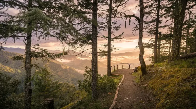
Bunches Bald Overlook (MP 459.5)
Bunches Bald Overlook at Blue Ridge Parkway milepost 459.5 looks west across the Raven Fork country to the Smokies, and it is a calm sunset stop a few miles from the Heintooga turnoff.
Cherokee, NC
Flat Creek Trailhead (Heintooga Ridge Road)
The Flat Creek Trail starts beside Heintooga Picnic Area, where Heintooga Ridge Road climbs into red spruce and Fraser fir; it is a cool forest stop rather than a view, open through October 31.
Cherokee, NC
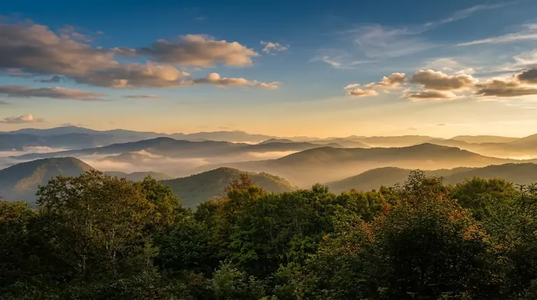
Heintooga Overlook
Heintooga Overlook sits at the end of Heintooga Ridge Road, about nine miles off the Blue Ridge Parkway, with a picnic area and a high-country view; the road closes October 31.
Cherokee, NC
Heintooga Ridge Road Junction (Parkway MP 458.2)
At Blue Ridge Parkway milepost 458.2 a sign points to Heintooga Ridge Road and the park's high spruce-fir country; this junction is a place to check the road status before you commit.
Cherokee, NC
Kuwohi Parking Area (Forney Ridge)
The Forney Ridge lot at the end of Kuwohi Road is the starting point for the steep half-mile paved walk to the park's highest tower. The road is open through November 29, 2026.
Cherokee, NC
Kuwohi Road Junction Overlook
The Kuwohi Road junction pull-off, steps from Newfound Gap, is the decision point for the seven-mile spur to the park's highest tower; the road is open through November 29, 2026.
Cherokee, NC
Lickstone Overlook (MP 458.9)
Lickstone Overlook at Blue Ridge Parkway milepost 458.9 faces west over the Raven Fork country to the Smokies, a quiet pull-off a mile past the Heintooga turnoff.
Cherokee, NC
Mingus Mill Pullout (Closed)
Mingus Mill, an 1886 turbine-powered gristmill about two miles north of Cherokee on US-441, is closed until further notice for preservation work; the creekside lot and grounds are the short stop.
Cherokee, NC
Oconaluftee Valley Overlook (NC Side)
Oconaluftee Valley Overlook, on the North Carolina side of Newfound Gap Road, looks down the long Oconaluftee drainage, and has room for RVs and trailers to pull in and turn.
Cherokee, NC
Smokemont Overlook
A pull-off above Smokemont on Newfound Gap Road looks down the Oconaluftee valley, a lower, quieter stop on the North Carolina descent with the campground and river below.
Walland 9 entries
Walland, TN
Cades Cove Overlook (Foothills Parkway)
A pull-off on the Foothills Parkway's Walland to Wears Valley stretch that looks south at the ridges above Cades Cove, a high, quiet angle on the park that most visitors never see.
Walland, TN
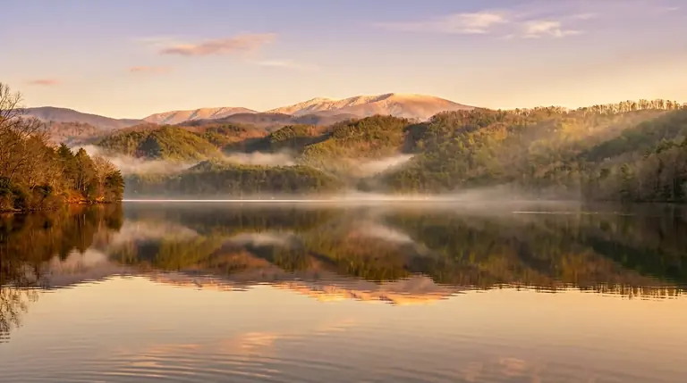
Chilhowee Lake Overlook
At the Foothills Parkway's western end the road looks across the Chilhowee Lake country: a quiet lake, a long ridge and far less company than the main park overlooks.
Walland, TN
Chilhowee Mountain Overlook
Chilhowee Mountain Overlook on the Foothills Parkway West looks over the lowlands to the main Smokies line and, unusually for a mountain view, is best at midday rather than sunrise or sunset.
Walland, TN
Foothills Parkway Overlook near Walland
At the Walland end of the Foothills Parkway's western section a small pull-off looks south at the Smokies over the Blount County farmland, an easy first stop from Maryville or Townsend.
Walland, TN
Foothills Parkway Pullouts
Between its named overlooks the Foothills Parkway West has small unsigned pull-offs that look south at the Smokies from a ridge, usually with one or two cars and nobody else.
Walland, TN
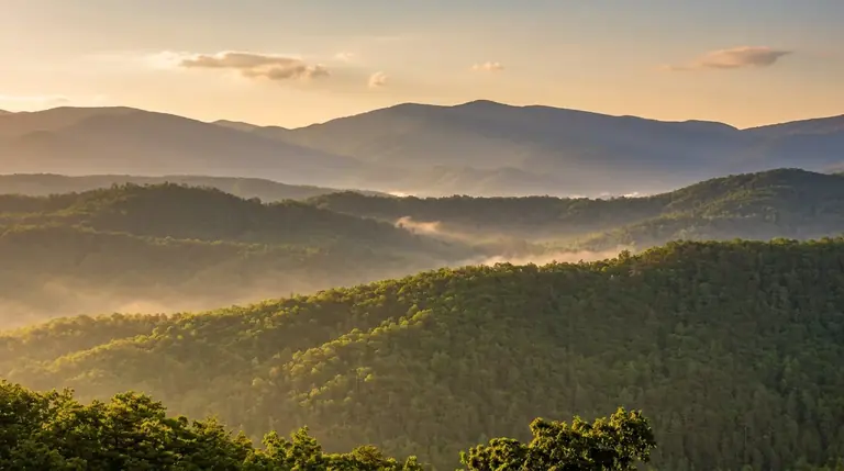
Happy Valley Overlook
Happy Valley Overlook on the Foothills Parkway looks down on the farm fields of Happy Valley with the Smokies rising behind, a quiet roadside stop best on clear mornings.
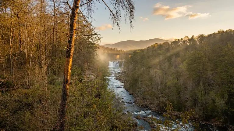
Walland, TN
Little River Overlook
Little River Overlook on the Foothills Parkway near Walland looks over the Little River valley as it leaves the mountains, a small, quiet pull-off with a view of the park's lower ridges.
Walland, TN
Look Rock Tower
Look Rock on the Foothills Parkway has a short walk to an observation tower with a 360-degree view of the Smokies ridgeline to the south and the Tennessee Valley to the north.
Walland, TN
Walland Overlook (Foothills Parkway)
A small Foothills Parkway pull-off above Walland looks over pasture and foothills to the Smokies, an easy add-on to a drive across the western Parkway with space for a few cars.
Robbinsville 5 entries
Robbinsville, NC
Cherohala Skyway Pullouts
The Cherohala Skyway has a string of unsigned pull-offs between its named overlooks, graveled spots where you can stop for ridgeline views with almost no other cars.
Robbinsville, NC
Hooper Bald Overlook
Hooper Bald sits near the high point of the Cherohala Skyway in North Carolina, with a treeless summit and open horizons in several directions, a rare unobstructed view on a mountain road.
Robbinsville, NC
Santeetlah Overlook
Santeetlah Overlook on the Cherohala Skyway looks north across the Joyce Kilmer wilderness toward Lake Santeetlah, a lake-and-forest view without the Parkway crowds.
Robbinsville, NC
Stratton Ridge Overlook
Stratton Ridge Overlook on the Cherohala Skyway looks across forested ridgelines near the Tennessee line, a quiet high-country pull-off with room for a few cars and no crowds.
Robbinsville, NC
Unicoi Crest Overlook (State Line)
Unicoi Crest Overlook on the Cherohala Skyway marks the high ridge where Tennessee meets North Carolina, with long views along the crest in both directions and a large pull-off.
Waynesville 4 entries
Waynesville, NC
Blue Ridge Parkway Pullouts (Mileposts 411 to 469)
Between Pisgah and Oconaluftee the Blue Ridge Parkway is dotted with small pull-offs and named overlooks, a 58-mile stretch where the road stays above 5,000 feet and every bend offers a view.
Waynesville, NC
Graveyard Fields Overlook (MP 418.8)
Graveyard Fields at Blue Ridge Parkway milepost 418.8 is a high, open valley of blueberry thickets and a waterfall trail; the parking lot fills by mid-morning on fall weekends.
Waynesville, NC
Waterrock Knob (MP 451.2)
Waterrock Knob at Blue Ridge Parkway milepost 451.2 has a seasonal visitor center and a short, steep trail to a 6,292-foot summit with a 360-degree view of the Smokies and the Plott Balsams.
Waynesville, NC
Wesner Bald Overlook (MP 448.1)
Wesner Bald Overlook at Blue Ridge Parkway milepost 448.1 looks toward the grassy bald of the same name and the Plott Balsam range, a quiet stop between Balsam Gap and Waterrock Knob.
Brevard 3 entries
Brevard, NC
Devil's Courthouse Overlook (MP 422.4)
Devil's Courthouse at Blue Ridge Parkway milepost 422.4 is a bare rock tower with a steep, short trail to a 5,720-foot summit and a 360-degree view that reaches into South Carolina and Georgia.
Brevard, NC
Rough Butt Bald Overlook (MP 425.4)
Rough Butt Bald Overlook at Blue Ridge Parkway milepost 425.4 is a small gravel pull-off with a view toward the forested bald that gives it its name, a short stop between Devil's Courthouse and Richland Balsam.
Brevard, NC
Wagon Road Gap Overlook (MP 411.8)
Wagon Road Gap at Blue Ridge Parkway milepost 411.8 is an old mountain crossing beside the US-276 junction, with a forested overlook toward Cold Mountain and the Pisgah ridges.
Tellico Plains 1 entry
Cosby 1 entry
Sylva 1 entry
Maggie Valley 1 entry
Wears Valley 1 entry
Where to stay
Near Smokies scenic corridors
Base near the corridor you most want to drive: Gatlinburg for Newfound Gap, Townsend for Foothills and Cades Cove, Cherokee for BRP and the east end, Robbinsville for Cherohala.
Map powered by Stay22, with live prices from booking sites. If you book through it, Mountain Insider may earn a commission at no extra cost to you. How we make money.