

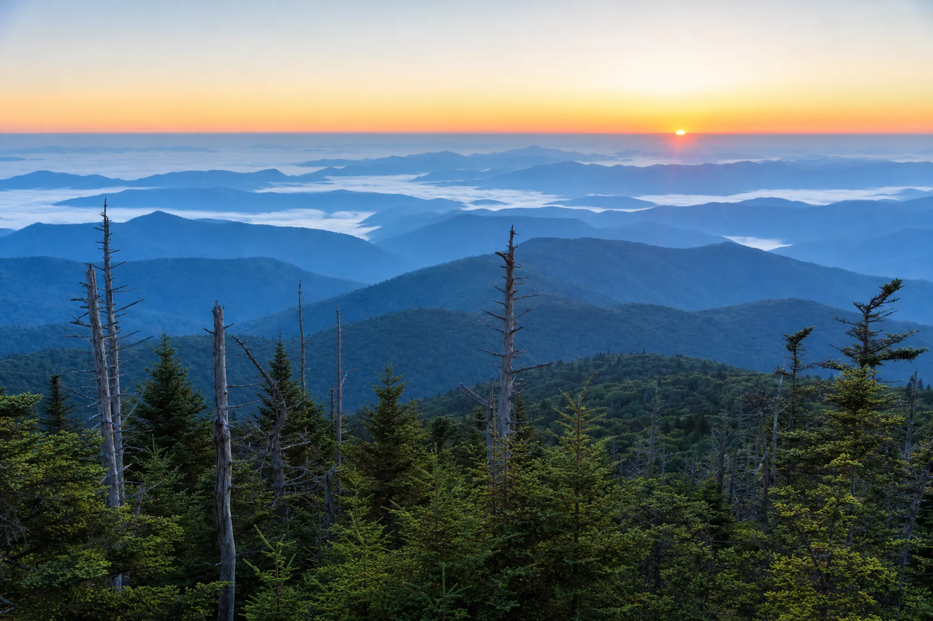
Kuwohi (formerly Clingmans Dome) is the highest point in Great Smoky Mountains National Park at 6,643 feet. The road to the parking area, Kuwohi Road, is open April 1 to November 29 in 2026, weather permitting. From the lot, a paved but very steep trail climbs 0.5 mile each way (1 mile round trip) to a round observation tower with panoramic views. Bring a jacket, because the summit is much colder and windier than the valleys.
The Park Service's Kuwohi page describes the walk as "paved but very steep." A parking tag is required if you park more than 15 minutes ($5 a day, $15 a week, $40 a year), no reservation or timed entry is needed, and federal passes are not accepted for the tag. The official site is the Park Service seasonal roads page, which lists the 2026 dates.
How do you get to Kuwohi?
Kuwohi Road leaves Newfound Gap Road near Newfound Gap, the pass on the Tennessee and North Carolina line, and runs about 7 miles to the parking area. From Gatlinburg, allow roughly an hour including the climb over Newfound Gap, and from Cherokee about the same. The Park Service says parking at Kuwohi often exceeds capacity and suggests considering a shuttle or parking at the end of the road. Park only in marked spaces with all four wheels out of the roadway, since towing is a real risk. The Kuwohi Visitor Center is a small building near the lot, and the Park Service lists Smokemont and Elkmont as the closest campgrounds.
What does Kuwohi mean, and why was Clingmans Dome renamed?
In September 2024, the mountain's name officially changed from Clingmans Dome to Kuwohi, its Cherokee name, which is commonly translated as "mulberry place." The change recognized the Eastern Band of Cherokee Indians, for whom the peak has long been a significant place. The Park Service now uses Kuwohi everywhere: Kuwohi Road, the Kuwohi Visitor Center and the tower. You will still see the old name on older maps, signs, guidebooks and trail listings, but the two names refer to the same mountain. To learn more about the people whose homeland this is, visit the Cherokee culture guide and the Museum of the Cherokee People.
When is Kuwohi Road open?
| Item | 2026 detail |
|---|---|
| Season | April 1 to November 29 |
| Road length | About 7 miles from Newfound Gap Road |
| Weather closures | Any time for snow, ice or other hazards |
| Reservations | None required |
| Parking tag | Required for more than 15 minutes |
| Restrooms | Pit toilets near the lot, closed in winter |
| Next reopening | Expected around April 1, 2027; not yet announced |
The road is closed from about December through March each year. Because it is high, ice and fog can close it on short notice even in April or November, so check the NPS road closure page before you drive. If the weather is bad at the bottom, it will be worse at the top.
What is the walk to the tower like?
The trail starts at the parking lot, passes the visitor information center and climbs steadily. It is 0.5 mile each way, paved, and rises roughly 330 feet, which is why the Park Service says "very steep." Take it slowly and pause as often as you need. At the top, a ramp spirals up to an open observation deck. On a clear day you can see for many miles across the Smokies and, on the best days, over 100 miles. In summer the view is often hazy, and in cloud you may see nothing, so build in flexibility. Cool, dry autumn mornings often give the clearest air.
The trail is paved but too steep for wheelchairs and many mobility devices. Dogs and bicycles are not allowed. If walking the ramp is not possible, the Newfound Gap overlook offers a big view with no climb. Our accessibility guide lists more options.
What should you expect from the weather at 6,643 feet?
The summit is typically 10 to 20 degrees cooler than the lowlands, and wind makes it feel colder. Fog and low clouds are common, rain showers can arrive in minutes, and snow is possible from fall through spring. The spruce-fir forest here is a different world from the valleys: dark, mossy and often damp.
- Pack: a warm layer, a windproof shell, a hat and gloves in shoulder seasons.
- Check the forecast for Kuwohi specifically, not Gatlinburg.
- Allow time: it is about an hour or more from Gatlinburg, and longer on a busy weekend.
When is the best time to visit for sunrise and sunset?
Sunrise and sunset are the best light, and the lot is calmest early and late. Mid-morning to mid-afternoon on summer and October weekends is the busiest window, and the Park Service warns of extreme crowding and limited parking. Plan to arrive well before 9 a.m. or after 4 p.m. For sunrise, confirm on the NPS site that the road is open and ask about gate hours before you plan a pre-dawn drive, because the seasonal roads page lists dates but no daily times. Sunset visits mean driving down in the dark on a winding road, so bring a headlamp and drive carefully. Photographers should check our photography guide for the cloud inversion and rime-ice conditions that make Kuwohi worth the climb.
What other trails start at Kuwohi?
Kuwohi is a trailhead as well as a viewpoint.
- Andrews Bald: 3.6 miles round trip from the Forney Ridge Trailhead, near the visitor information center. The Park Service calls the return a relatively strenuous climb. The reward is a grassy bald with wide views and, in June, flame azaleas.
- Forney Ridge Trail: the route that carries you toward Andrews Bald and beyond.
- Bypass trail: a spur from the Forney Ridge Trailhead toward the Appalachian Trail that offers views of Sugarland Mountain and the Elkmont area.
- Appalachian Trail: Kuwohi is also the highest point on the entire 2,190-mile Appalachian Trail, which passes just beside the tower.
- Look Rock Tower (0.8 mile round trip) on the Foothills Parkway is a lower tower alternative.
Pets are not allowed on these trails. See the hiking guide for more.
Can you visit Kuwohi in winter?
Not by car. After November 29, 2026 the road closes for the season, and it can close earlier. Winter is a different trip: visitors sometimes walk or ski the closed road, which is about 7 miles each way, but the Park Service does not publish the current rules for the closed road on its seasonal roads page, so call 865-436-1200 and check the closures page first. Ice, deep snow, wind and early dark make this a serious outing for experienced and well-equipped hikers only. For a gentler winter option, try Newfound Gap, which is on a year-round road, weather permitting. See the winter guide for more.
Where should you stay near Kuwohi?
The closest bases are Gatlinburg on the Tennessee side and Cherokee and Bryson City on the North Carolina side. Gatlinburg offers more lodging and dining, while Cherokee is closer to Oconaluftee and quieter. Use the map below to compare stays by distance to Newfound Gap Road.