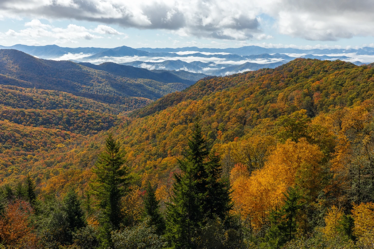

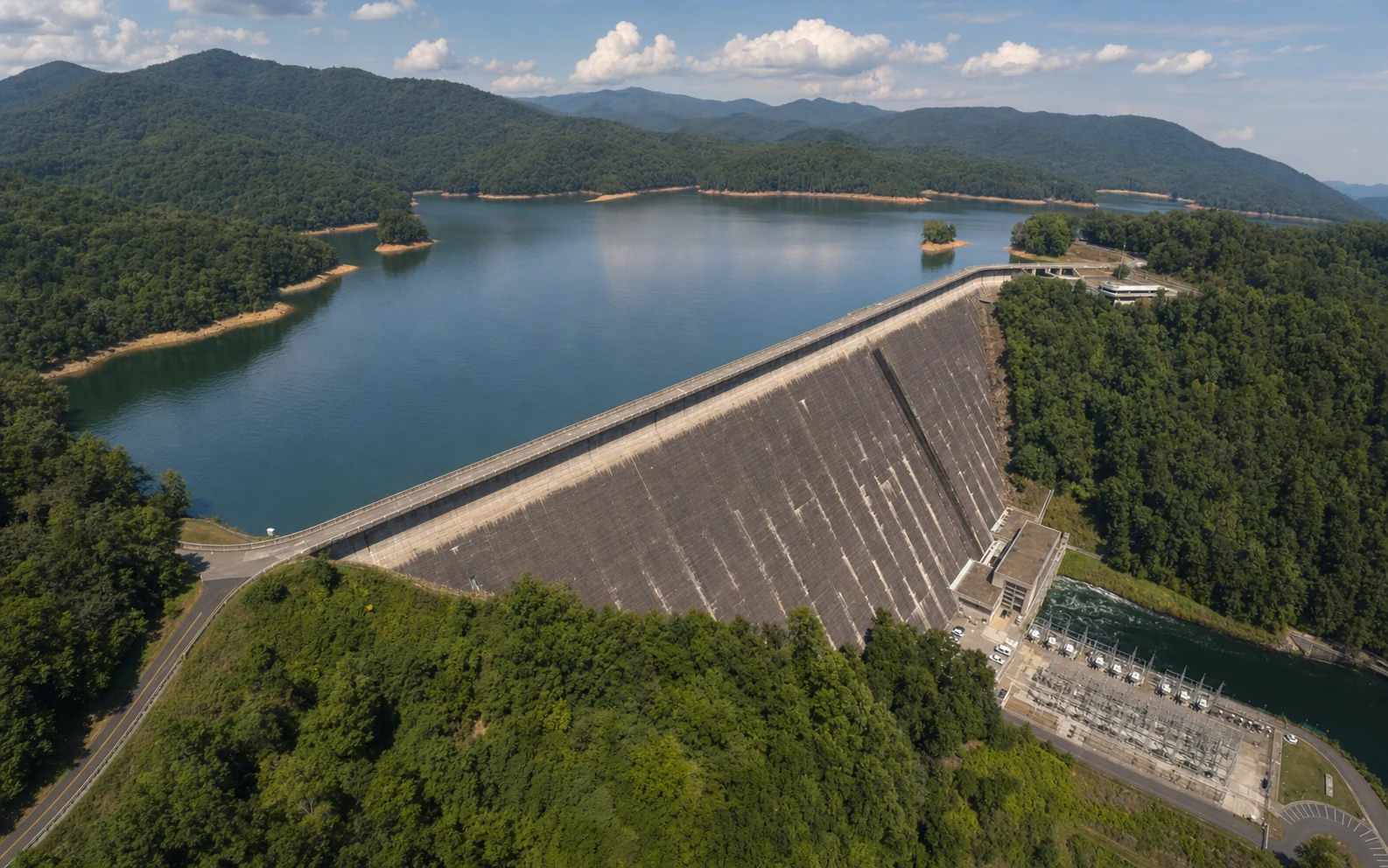
Fontana Lake and Fontana Dam sit on the southern edge of Great Smoky Mountains National Park, about 30 miles west of Bryson City. The dam, completed in 1944, is a 480-foot concrete arch — the tallest east of the Mississippi when it was built — and the lake it formed is a 10,230-acre reservoir with 240 miles of shoreline, much of it bordering the least-visited backcountry in the national park. The site blends World War II engineering, Appalachian Trail lore, houseboating, fishing, and the unresolved history of submerged communities and a broken federal promise. For visitors willing to drive the extra distance from the main gateway towns, it offers a quieter, deeper angle on the Smokies than anything available closer in.
The dam: 480 feet of wartime engineering
Fontana Dam was built in less than three years by the Tennessee Valley Authority, completed in 1944 to feed electricity into aluminum production for the war effort. At 480 feet tall, it was the tallest dam east of the Mississippi at the time of its construction, and the curved concrete arch spanning the Little Tennessee River is still a genuinely arresting piece of civil engineering — best appreciated from the visitor center overlook on the south rim or from the river gorge below.
Visitors can drive or walk the 2-mile crest of the dam, which offers panoramic views of the lake stretching east and the gorge dropping away to the west. Pedestrian access is uncomplicated — the road surface is wide, with guardrails on both sides — and the walk is one of the more unusual perspectives available on a TVA project.
The TVA Visitor Center at the dam operates seasonally, typically May through October, 9 AM to 6 PM. Interpretive exhibits cover the construction timeline, the TVA's broader mission, the geology and ecology of the Little Tennessee watershed, and the hydroelectric generation process. Staff can answer practical questions and point to hiking and boating access. Operating hours for 2025-2026 should be confirmed on the TVA website before a visit — seasonal schedules occasionally shift.
The Appalachian Trail crosses the dam
The Appalachian Trail runs directly across the crest of Fontana Dam, which makes the site a meaningful waypoint for long-distance hikers. Northbound thru-hikers reach Fontana after climbing out of the Nantahala Gorge and use it as the unofficial entry point to the Smokies section — a moment of civilization before a week in the backcountry. The shelter complex just south of the dam is known among hikers as the "Fontana Hilton": a large three-sided shelter, hot showers, flush toilets, and pay phones, all maintained by the ATC and TVA. Day visitors can walk portions of the AT from either end of the dam for short, scenic forays onto the long trail.
Fontana Lake: 10,230 acres, 240 miles of shoreline
Below the dam, Fontana Lake sprawls through steep, forested mountain terrain — a reservoir formed by the impoundment of the Little Tennessee River, with much of its northern shoreline forming the southern boundary of Great Smoky Mountains National Park. The scale is hard to register from any single vantage: 10,230 acres of surface water with 240 miles of shoreline, most of it protected and undeveloped.
Houseboating is the signature way to experience the lake's scope. Almond Boat Dock (1222 Almond Boat Road, Bryson City) is a primary provider, with rentals ranging from smaller family-friendly vessels to larger multi-deck models. A houseboat rental turns the lake's coves, secluded beaches, and wooded shorelines into a multi-day itinerary — anchor in a quiet cove for the night, swim off the stern in the morning, motor to a new arm in the afternoon. Reservations for peak summer 2025-2026 should be made well in advance. Almond Boat Dock also rents pontoon boats, fishing boats, and carries a general store's worth of on-water supplies.
Fishing is a second major draw. Fontana is well-known for smallmouth bass and walleye, with strong secondary fisheries for crappie, catfish, and various panfish. The cooler, deeper sections support trout populations as well. A valid North Carolina fishing license is required (purchasable online through the NC Wildlife Resources Commission), and current creel limits and size restrictions apply.
For visitors who want water access without committing to multiple days on a houseboat, Fontana Marina runs boat shuttles across the lake. The shuttles serve Appalachian Trail thru-hikers and — critical for day-trippers — provide access to the Hazel Creek backcountry, which is otherwise reachable only by long wilderness hikes.
The Tsali Trail System: world-class mountain biking adjacent
A short drive from Fontana Dam, the Tsali Recreation Area (USDA Forest Service) offers roughly 40 miles of purpose-built singletrack on four distinct loops. The trails are generally intermediate to advanced, with extended climbs, long flowing descents, and technical rock and root sections threading through dense hardwood forest. Tsali is regarded as one of the best mountain biking destinations in the Southeast.
A distinctive feature: the loops alternate between mountain bikers and horseback riders on a daily schedule — two of the four loops are open to bikes on any given day, with the other two reserved for equestrian use. Before arriving, check the current day-use schedule on the USDA Forest Service Tsali Recreation Area page for the assigned loops, parking fees, and any trail closures.
Submerged communities: Hazel Creek and the lost world
Fontana Lake is not only a reservoir — it is the cover over a disappeared landscape. Before the dam, the Little Tennessee River valley was home to thriving Appalachian communities, particularly in the Hazel Creek drainage. Towns like Proctor and Judson had farms, churches, schoolhouses, and cemeteries; they were isolated by the mountain terrain but self-sufficient and rooted in generations of family history. The reservoir's filling submerged almost all of it. Thousands of residents were displaced, homes were lost, and family cemeteries ended up underwater or marooned on the park-side shore.
Today, old foundations and overgrown cemeteries are occasionally visible at low lake levels, and the former homesites can be reached on foot from boat-shuttle drop-offs. The Calhoun Cemetery is one of the more frequently visited restored sites. The story of the displaced families is a central thread of the region's cultural fabric — a reminder that the reservoir's recreational value came at a documented human cost.
Access to the Hazel Creek area today is essentially boat-only. Fontana Marina shuttles drop hikers, anglers, and history-minded visitors at various points along the Hazel Creek arm, where old logging roads and the restored cemeteries can be explored on foot. The service opens up backcountry that is otherwise days of walking from any road.
The Road to Nowhere
The Road to Nowhere, officially Lakeview Drive, is the other central story the reservoir left behind. When the federal government acquired land for the dam and expanded the national park, it promised displaced residents on the north shore a new road that would give them access to their family cemeteries across Fontana Lake. Construction began but was never finished — environmental concerns, engineering challenges, and shifting priorities left the road abruptly ending six miles into the national park at a striking mile-long tunnel.
Today, visitors can drive the paved section of Lakeview Drive out of Bryson City, pass through the tunnel, and turn around at the end. The unfinished road stands as a physical broken promise — a genuinely moving stop for anyone interested in the region's history. Several hiking trails radiate from the end-of-road trailhead, leading deeper into the park and connecting to some of the historic cemeteries and old communities. The Road to Nowhere trailhead sits inside national park boundaries, which means the Park-It-Forward parking tag applies to any vehicle parked more than 15 minutes. Tags are $5 daily, $15 weekly, or $40 annual, available online at recreation.gov.
Fontana Village Resort: base camp for the area
For visitors who want to spend more than a day on the south side of the park, Fontana Village Resort is the main lodging option within the immediate area. The resort sits directly on the lake with a range of accommodation types — historic lodge rooms, cabins, and camping sites — plus dining, a marina, swimming pools, and bundled recreational offerings. It functions as a self-contained destination and is a common stop for Appalachian Trail thru-hikers in need of real beds and hot meals.
Beyond Fontana Village, Almond Boat Dock serves as a secondary hub on the northeastern arm of the lake, with rentals and a general store. The nearest full-service town is Bryson City, roughly 30 miles east, with a broader range of lodging, restaurants, and services — including the Great Smoky Mountains Railroad depot.
Regional context and what's new for 2025-2026
Two region-wide updates matter for Fontana visitors:
- Park-It-Forward parking tags, in place since 2023 and continuing into 2025-2026, are required for any vehicle parked more than 15 minutes inside Great Smoky Mountains National Park. The Road to Nowhere trailhead and any stops inside park boundaries fall under this rule. The dam itself is TVA property and is not subject to the tag.
- Clingmans Dome was renamed Kuwohi, restoring the ancestral Cherokee name for the highest peak in the park. While the change doesn't directly affect Fontana, it is part of a broader effort by the Eastern Band of Cherokee Indians and the National Park Service to acknowledge the region's indigenous history — worth noting given Fontana's proximity to Cherokee lands.
No major new attractions or closures are anticipated directly at Fontana for 2025-2026, but TVA visitor center schedules and boat-shuttle operating seasons should always be confirmed on the official sites before a visit. Post-wildfire rebuilds in other parts of the region continue, but Fontana's immediate surroundings were largely unaffected.
Getting there
From Bryson City, Fontana Dam is about 30 miles west via US-74 and NC-28, a drive of roughly 45 minutes through mountain terrain. From Cherokee, add another 20 minutes. From Gatlinburg or Pigeon Forge, the drive runs about 2.5-3 hours — US-441 south through the national park to Cherokee, then west to Bryson City and on to the dam. Visitors with a full day should plan to see both the dam and the Road to Nowhere, which are on opposite sides of the lake and require backtracking through Bryson City.