About Abrams Falls Trail
Abrams Falls is only about 25 feet tall, but Abrams Creek drains a big slice of the park's west end, so the water going over the lip is heavy and loud. You hear it well before you see it. The National Park Service lists the hike at 5 miles round trip (2.5 miles each way), and with about 675 feet of total climbing spread over rolling terrain it rates as moderate.
The hike
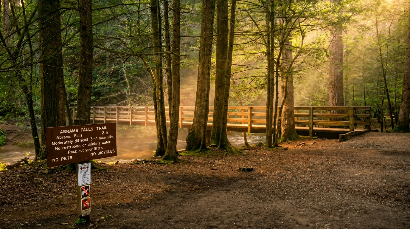
The trailhead is on Abrams Falls Road, a short spur off the Cades Cove Loop Road near Stop 10. The path crosses Abrams Creek on a footbridge, then climbs and dips along a pine-oak ridge above the water before dropping to the pool. Expect roots, loose rock and a handful of steady climbs instead of one big hill. The last stretch descends to the falls, which means the first climb on the way back is the one you will feel.
The pool below the falls looks inviting and it is not. NPS warns that swimming is not recommended because of slick rocks and a dangerous undertow, and people have drowned here. Stay at the edge, keep kids close, and wear shoes with grip.
When to go
Spring brings the strongest flow and wildflowers along the lower trail. Summer is shady but crowded, and the small trailhead lot is often full by mid-morning on weekends, so go early or on a weekday. Cove hardwoods below 4,000 feet usually peak from mid-October to early November, which is also when Cades Cove traffic is at its worst. Winter is quiet, but shaded sections near the falls can ice over.
Getting there
From the Townsend entrance, follow Laurel Creek Road into Cades Cove and drive the one-way loop to Abrams Falls Road. The loop is open sunrise to sunset, and from early May through September it closes to cars every Wednesday (May 6 to Sept. 30 in 2026) for bikes and walkers, so plan this hike for another day unless you want to pedal in.
Entry to the park is free, but a parking tag is required if you park more than 15 minutes: $5 a day, $15 a week or $40 a year. America the Beautiful and other federal passes do not count, and the tag has to be displayed in the vehicle.
Know before you go
Carry more water than you think you need; there is nothing to refill on the trail. Black bears are common in Cades Cove and work the creek corridor, so keep at least 50 yards away and never leave food in a pack on the ground. Cell service is poor, and pets are not allowed on this trail. Check the trail conditions page before you drive in.
Good to know
- How long is Abrams Falls Trail?
- Abrams Falls Trail is 2.5 miles one way (5.0 miles round trip), with about 675 feet of climbing. It is rated moderate.
- Are dogs allowed on this trail?
- No. Inside Great Smoky Mountains National Park, dogs are allowed only on the Gatlinburg Trail and the Oconaluftee River Trail.
- Do I need a parking tag to hike here?
- A Park It Forward parking tag ($5 a day, $15 a week or $40 a year) is required for any vehicle parked more than 15 minutes inside Great Smoky Mountains National Park. Entry is free, and federal passes such as America the Beautiful do not replace the tag.