About Lynn Camp Prong Cascades
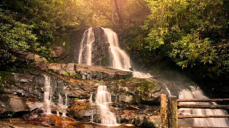
Lynn Camp Prong rushes and tumbles over and around numerous rocks as it cascades down the mountain beside the Middle Prong Trail near Tremont. The Park Service lists the hike as 1.4 miles round trip on an old logging railroad bed that is mostly wide and relatively level, rising gently through rhododendron and past cliff-like rock outcrops.
The walk
The trail leaves the Middle Prong Trailhead at the end of Upper Tremont Road and follows the Middle Prong of the Little River. It narrows in a few places where washouts have occurred, but it is an easy and shaded outing for most families. Wildflowers bloom along the trail from spring through summer. The first 1.3 miles have been assessed for accessibility, and the park offers free Freedom Chairs; ask at the nearest visitor center.
At the cascades
The creek drops through a series of ledges and pools. The water is cold and the rocks are slick, so keep your footing on the trail and do not climb. This corridor is high enough that flow stays strong in dry months.
Getting there
From Townsend, follow Little River Road and Tremont Road to the Great Smoky Mountains Institute at Tremont, then continue on unpaved but well-maintained Upper Tremont Road to the trailhead. Entry to the park is free, but any vehicle parked more than 15 minutes needs a parking tag ($5 daily, $15 weekly, $40 annual). Federal passes such as America the Beautiful do not replace it, and the tag must be displayed in your vehicle. The nearest restrooms are at the Great Smokies Welcome Center in Townsend.
When to go
- Spring: Strong water and wildflowers.
- Summer: Shaded, and cooler than the valley.
- Fall: Good color along the old railroad grade.
- Winter: Ice can form on the trail; carry traction.
Know before you go
Dogs are not allowed. Cell service is poor. The Middle Prong Trail continues for miles beyond the cascades if you want a longer walk.
Good to know
- How far is the hike to Lynn Camp Prong Cascades?
- It is about 0.7 miles each way, rated easy.
- Can you swim or climb at the falls?
- Please don’t climb on or around waterfalls. Wet rock and algae are extremely slick, and falls from waterfalls are a leading cause of death in the Smokies. Enjoy the view from the trail.
- Do I need a parking tag?
- A Park It Forward parking tag ($5 a day, $15 a week or $40 a year) is required for any vehicle parked more than 15 minutes inside Great Smoky Mountains National Park. Entry is free, and federal passes such as America the Beautiful do not replace the tag.